The colours of Autumn
Once out of the station of Meduno (0.00 km), onto the road with the same name: via della Stazione, go up to the roundabout. Take the third turning towards Tramonti–Passo Rest. (If the second turning is taken towards Toppo, there is a brief stretch of approx 700-800 m that leads to the remains of a castle). Therefore, continue towards Meduno; to the right is a small church dedicated to S. Bartolomeo and in front is a beautiful mountain landscape in the foreground of the Col della Luna and just behind, Monte Raut that surrounds the valley. The road taken along the valley of the Meduna Torrent is quite narrow with frequent bends and no bike lane, so it is best to keep to the right to avoid any traffic from behind, which luckily is not too heavy.
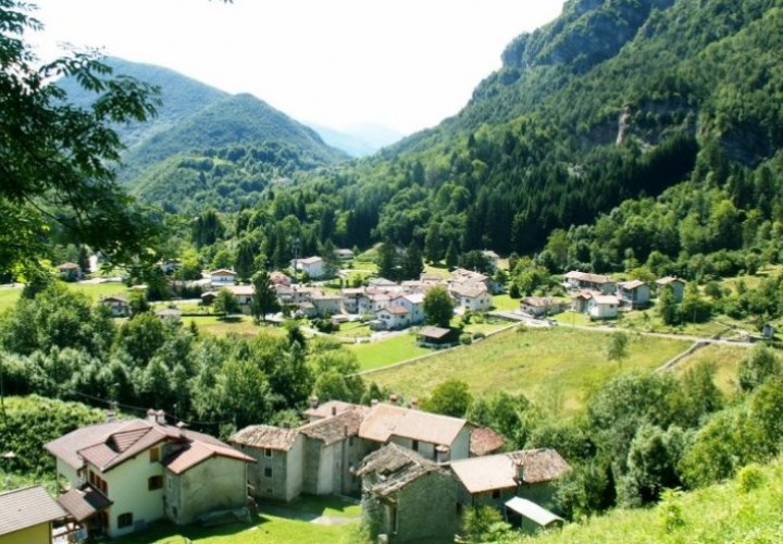
The town of Meduno (2.00 km) is quaint and orderly and all the houses have been renovated following the terrible earthquake in May 1976. The old parish church of Santa Maria di Meduno (1186) preserves a canvas of “La Madonna con Santi” (the Madonna with Saints) by the Venetian artist G.B. Piazzetta. Hamlets of interest are Sottomonte and Navarons (from the Friulian language: place in a dell, surrounded by mountains). After the town, the houses are more scattered and the slight ups and downs are excellent for a warm up. The route continues through the hamlets of Pitagora, Romaniz, Avon (5.7 km) and it is possible to admire the beautiful crown of mountains. Before you know it you have reached Ponte Racli (7.0 km). The double-bend dam built in 1952 crosses the valley, connecting the right side of the Meduna Torrent towards Chievolis and forming the Lago di Redona (Redona Lake).
The wastewater is conveyed to Maraldi and then to the Colle power station. Continue towards the right, leaving the dam to the left and the water gates that adjust the level of the lake, to reach Redona. (During the summer season, when the lake is at its lowest level, the old houses submerged by the reservoir can be seen). Along the road that flanks the lake in località Miar to the left (8.5 km) there is a small ramp if you want to test your muscles before the climbs that follow and drink something at the bar, which is located at the top, otherwise continue along the main road SS 552 up to Ponte Chiarsò (10.6 km). Take the right turning onto the provincial road SP 57, following the signs to Clauzetto, Grotte di Pradis. The road that leads into the valley with the same name where the Chiarzò Torrent flows is in the shade and delves into the mountain along sections of road with different gradients.
The road is lined with woods. There is very little traffic, except for the summer period when there are tourists visiting the Grotte di Pradis (Caves of Pradis); nevertheless the environment is so natural that the silence is broken by the running water of the torrent flowing into the lake. Through a few natural openings in the woods to the right, Monte Ciaurlec (1168) can be seen from various positions. Following a few climbs and short descents, past Località Tallon, the remains of an old house can be seen and then the clear waters of the Chiarzò Torrent to the right, leading to the widening of Campone in località Grisa (16.5 km – 448 m.asl). Passing through the hamlet of Tramonti di Sotto with its renovated church and bell tower, a beautiful sundial can be seen as well as a few houses that are enlivened mainly during the holiday period by immigrants or people coming from the plains. Again, the houses have all been renovated after the earthquake and luckily many of them have maintained their original appearance. The climb continues, passing località Pagnach, località Belloz and the reservoir of the aqueduct, turning left at the next junction or descending towards the right to see the characteristic group of houses, località Zulian that is slightly on a rise, the 18 Km milestone in Clauzetto to the right, località Sciaf, località Valent, località Sgualdin leading to località Piani, the highest point of our tour (675 m.asl – 20.00 km up to this point).
The route continues with a descent past an agritourism to the right and little effort to the crossroads of Gerchia (22.80 km). To the left is an Inn where, if it is the right time, you can stop over or lunch, welcomed by simple and social people. The place also offers several opportunities to visit the magnificent Grotte Verdi di Pradis (caves) going down a long flight of steps to reach the Grotta della Madonna where evidence of a prehistoric settlement has been found. If there is little time and if it is open, the museum to the right of the Inn can be visited. The route proceeds by turning right into via Pradis di Sotto and without much effort to the right into via Blarasin at Clauzetto. When entering the village, there is an old school where an air pioneer, Ugo Zannier, built a glider called Friuli in the 20s. Continue along the road through the centre of the village until reaching the church of S. Giacomo (26.30 km), which is also called the church “of the spirited”, because two centuries ago on the first Sunday of July, the spirited used to gather here and climb the beautiful flight of steps on their knees up to the terrace on which the church is built.
It is also renowned for the altar made of Carrara marble, the baptistery that is finely inlaid, the picture portraying S. John the Baptist by the Friulian artist, Odorico Politi. Another interesting piece of architecture is the church of S. Martino that dates back to approximately 1503. The village is known as the “Balcony of Friuli” because on a good day the view from the square in front of the church of S. Giacomo stretches from the valley of the Tagliamento River right up to the Adriatic sea and the Colli Euganei hills. The route proceeds by going round the church square and taking an immediate left turn towards Tolmezzo. The road is wide, scenic with an easy, apparently flat surface, followed by a descent leading to Vito D’Asio on via Iacopo Ortis (28.00 km). Having reached the end of the village, follow the sign to Anduins at the first junction, looking out for any cars coming uphill as you proceed along the bends on the descent. Anduins is soon reached along via Baquet (31.30 km) and turning right, the descent continues up to the junction on the provincial road.
Turn right following the sign for Pinzano al Tagliamento. Along the descent there is a small fountain (34.40 km) where you can top up your water bottle and then continue down along the bends to reach Cassiacco (35.60 km). Here, you can start to slow down at the first apparently flat section of road to admire the Arzino Torrent, which gives its name to the valley, on the left. A small walkway, which can be visited on foot, makes it possible to admire the speed of the water. A little further on, at the big junction, turn left, cross the bridge and immediately turn right where there is the sign Cornino into via Stazione. Turn left into via della Madonna following the sign for S. Daniele (36.20 km). Cycle along the Provinciale Napoleonica and after a narrow underpass - “watch the bottleneck” - that goes to the right, the railway line that had been left in Meduna, can be noticed to the left. This will continue for a good section of the route until the next underpass where a right turn will be taken (38.70 km) to reach the village of Cornino: “the village over the river”. This village, as well as Flagona, where there are medieval ruins of an old castle that are worth a visit, and S. Rocco, the village that can be seen to the left high on the mountain, belong to the areas of Forgaria del Friuli.
This area is rich in Roman findings that prove their presence since the second century b.C. For centuries the territory was under a feudal system of various dominations that forced the peasants to work the fields and pay taxes; this in itself caused workers to migrate to Germany, the Austrian Hungarian Empire, Romania and Siberia. Napoleon slightly improved the living conditions by abolishing the feudal bonds. Upon reaching the “Ai Glicini” Tavern (40.30 km) it is worth stopping for something to drink and perhaps a ham sandwich (with S. Daniele prosciutto) in the shade. From here to the station of CORNINO, the last part of the itinerary, there are still 400 metres to go, by turning right at the sign for S. Daniele del Friuli. The station, which was destroyed in the 1976 earthquake has not been rebuilt and now there is only a simple canopy for waiting under (41.00 km).
End of the tour.

